Monday, February 27, 2017
Maps for cub scouts
Maps for cub scouts
Scouting Ireland. Orienteering for Beavers, Cubs, Scouts . . . https://my.scouts.ie/uploads/files/One%20Programme/Orienteering_v3_1.pdf
1. Orient the map. Using features, sun or compass.
orient etymology:
The Orient - The Eastern World - Where the sun rises: Asia, China, Japan(the land of the rising sun - Nihon), e.t.c. To orient oneself - "to arrange facing east," from French sorienter "to take ones bearings," literally "to face the east". Origin latin "oriri" to rise -- latin "orient" rising or east -- french/english. During Roman and Medievial times it was common for maps to be drawn with East at the top. Orienteering as a sport was created by Swedish military around 1886 as training for navigating on land.
http://www.etymonline.com/index.php?term=orient
http://en.wikipedia.org/wiki/Orienteering
http://www.orienteering.ie/
Babylonian clay tablet. "Imago Mundi". 600BC.

This picture is an interpretation of the original tablet.
Babylonia in the center of the map.
The Bitter River (salty sea) surrounding Babylonia.
Seven or Eight islands beyond the Bitter River.
Heavenly ocean and Animal constellations beyond the Islands.
http://www.henry-davis.com/MAPS/AncientWebPages/103.html
http://www.henry-davis.com/MAPS/AncientWebPages/103Amono.html
http://en.wikipedia.org/wiki/Early_world_maps#Babylonian_Imago_Mundi_.28c._600_BCE.29
Herodotus World Map 450BC.
Herodotus was a Greek born in what is now part of Turkey which was in the Persian Empire. He is known as the father of History. He traveled and collected information about history and geography and people, he tested the material to see if it was true and he wrote down the facts. Of course he has also been called the father of lies! The description of countries, seas, rivers and mountains in Herodotus Histories have been used to create maps.

http://www.henry-davis.com/MAPS/AncientWebPages/109.html
http://www.henry-davis.com/MAPS/AncientWebPages/109mono.html
http://en.wikipedia.org/wiki/Herodotus
Roman Map of the world. Orbis Terrarum. 20AD.
East at the Top.
The meditteranean sea and Italy/Rome close to center of map.
Note the river Nile rising in the mountains of Africa and flowing through Egypt to the Nile Delta.

http://www.henry-davis.com/MAPS/AncientWebPages/118mono.html
Ancient Roman Map. Tabula Peutingeriana
 This ancient roman map is a small section of the famous Tabula Peutingeriana: An ancient Roman
 http://www.mariamilani.com/rome_maps/ancient_roman_map.htm
http://www.mariamilani.com/rome_maps/Roman_Empire_Maps.htm
Ptolemys map of the World. 100AD to 15th century
http://en.wikipedia.org/wiki/Ptolemy
Ptolemy was Greek. He lived in the city of Alexandria in the Roman province of Egypt, He was a scientist and worked on mathematics, astronomy and geography among other things. His work on geography was recorded in a work called the Geographia. The Geographia is a collection of Greco-Roman geographic knowledge of the world and a description of how to make an accurate map. Ptolemy created a mathematically accurate map projection. He assigned co-ordinates to every place and projected the features from the world globe on to the map. His maps and tables were copied until the 15th century with both errors and improvements being made by the copiers. The latest Ptolemic maps we have are from the later medieval copies.

http://www.henry-davis.com/MAPS/AncientWebPages/119.html
Ptolemys map of Ireland:
http://irisharchaeology.ie/2011/11/roman-contacts-with-ireland/
Mappa Mundi. Medieval European maps of the world.
Any medieval European map of the world in a circular style is called a Mappa Mundi.
Of course at this time maps originally from Roman maps, Ptolemy projection style maps and others were in books and were being copied. The Mappa Mundi were stylised circular maps. With North or East on the top. Often with religious or other mythical imagery included.
http://en.wikipedia.org/wiki/Mappa_mundi
There are several distict types of mappa mundi:
- Zonal maps - zones from North to South: Arctic, Europe/Asia, Africa, Antipodes and Antartica
- Tripartite or "T-O" maps - with a division of Asia(the East) on Top and Europe and Africa (the North and South) below
- Quadripartite maps - like T-O maps adding in the Antipodes.
- Complex maps - with same layout as T-O and Quadripartite maps but with considerable more detail
Medieval Islam Map example
South is to the top of the map.
See the river Nile rising in the mountains and flowing through Egypt ot the Nile Delta.
The center of the map was the area best known to the map makers.
This one style seems quite like the complex mappa mundi.

http://en.wikipedia.org/wiki/Geography_and_cartography_in_medieval_Islam#Mathematical_geography_and_geodesy
Some fun with medieval map monsters. Hic svnt Dracones!
http://www.oshermaps.org/education/K12-lesson-plans/medieval-maps-and-monsters
http://www.telegraph.co.uk/culture/art/artsales/4986559/400-year-old-map-collection-for-sale.html
http://www.google.ie/search?q=Islandia+map+monsters&source=lnms&tbm=isch&sa=X
Eventually . . .
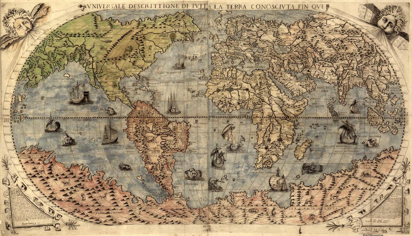
https://blogger.googleusercontent.com/img/b/R29vZ2xl/AVvXsEgtrn-7AedmjPLw2bo45KxeBiC2GpfST5eztwQ1YnEvB8qMeQe9wckMwwnuuCyCZuBKCR5QB34CTSuwC1-ztBfXVEnt926ETleyhGCEm5Sm13ybP5kEA0QwK3lTHTI_mJfOJ41Jm6Fu_ko/s1600/old-world-map.jpg
Available link for download
.png)

Sunday, December 25, 2016
Mapathon 2013 Join Google In Creating Better Maps for India
Mapathon 2013 Join Google In Creating Better Maps for India
To provide better maps for India , Google India has announced Mapathon 2013, Indias first mapping competition.Just sign up for the competition and update the maps via Google Map Maker. Once an entry has been submitted to Google, it will be verified and then added to Google Maps. Apart from adding new locations, you can also simply update sites that are already listed on Google Maps You can newly add those places you consider important — such as College, Office , Park or a nearby hospital.

Registrations for the competition, which commences on February 12 and concludes on March 25, 2013, have begun. The top 1000 mappers stand a chance to win 10 Samsung Galaxy Note, 800 Android Tablets , 40 Samsung Galaxy S II GT I9100 Android Phones , 50 Flipkart gift coupons worth Rs. 5000 each , 1000 Google Mapathon 2013 t-shirts and certificates (includes the top 100 above and another 900 people)


Available link for download
Thursday, November 17, 2016
Maps Me APK App For Android Free Download
Maps Me APK App For Android Free Download
Maps.Me APK - Offline Map & Routing is thoroughly optimized Android application with tons of maps and direction across the world.

Maps.Me Android App Store APK Free Download Full Version
The different thing of this app is that it can even work without any internet connection.Maps.Me App Features:
- Getting lost while traveling, hiking or walking to any new place is old tale now because this tool is packed with GPS navigation.
- Also, Maps that you will find for offline mode are also completely described and detailed.
- And maps that keep showing your exact paths to reach your destination.
- Map users contribute in updating of this android application, so this app also provides you names and contact info of Metro or subway stations, Petrol Stations, Restaurant and Tourist attractions.
- Download Copilot GPS Android Cracked Free
- Download Navmii GPS World (Navfree) Android App Free
- Free Waze Social GPS Maps & Traffic Download Android
- Free GPS Navigation & Maps By Sygic Premium Apk Download
Available link for download